Lake Wylie fishing conditions · South Carolina

Today, 12 pm–1 pmCrappie

The bite peaks at 90.

Log a trip here
Right now: 70 for crappie, worth the tripTap or drag along the water to move through the next 36 hours

Crappie, hour by hour

Each float is an hour. The deeper it rides, the better the bite. The strip underneath runs daylight, dusk and dark; the red rule marks the best window. Click any hour to read it.

  1. 703 am
  2. 72
  3. 72
  4. 726 am
  5. 72
  6. 72
  7. 729 am
  8. 72
  9. 80
  10. 9012 pm
  11. 82
  12. 82
  13. 803 pm
  14. 80
  15. 80
  16. 806 pm
  17. 80
  18. 80
  19. 709 pm
  20. 65
  21. 65
  22. 65Tue
  23. 65
  24. 70
  25. 703 am
  26. 70
  27. 70
  28. 706 am
  29. 65
  30. 65
  31. 659 am
  32. 65
  33. 65
  34. 6712 pm
  35. 72
  36. 90
Go, 85+Worth the trip, 70+Marginal, 55+Sit it out

Right now

Water
No reading

Crappie range 50–80°

Wind
2 mph

From the north

Light
Dark

Sunrise 7:39 am

Sky
Clear

No rain expected

Air
47°F

NWS hourly forecast

Barometer
Steady

Measured, last 3 hours

Moon
100% lit

Full

What’s biting

Each species is scored against its own water-temperature range and tide preference, then wind, weather and warnings. The rules are South Carolina regulations for these waters.

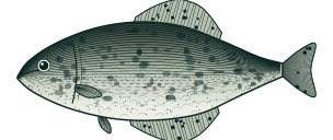
Crappie

Crappie

Pomoxis spp.

90GoToday, 12 pm–1 pm

Water

No water reading here right now. Crappie bite in 50–80° water, best near 65°.

Why

Crappie is showing up in this week's state fishing report for the area. Fish feed actively ahead of a pressure drop. Light chop — baitfish active, fish willing to feed. Holds 3–20 ft down.

Keep

8" minimum · 20 a day

Open. Keep fish within the limits. South Carolina statewide: 8" minimum, 20 crappie a day, within the 40-fish daily game fish total.

Verified Oct 23, 2026 · South Carolina

Season here: Feb–May, Oct–Dec, estimated from local air temperature, 2023–2025; there is no water gauge here. More on crappie
Largemouth Bass

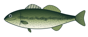
Largemouth bass

Micropterus salmoides

78Worth the tripToday, 12 pm–1 pm

Water

No water reading here right now. Largemouth bass bite in 55–85° water, best near 72°.

Why

Fish feed actively ahead of a pressure drop. Light chop — baitfish active, fish willing to feed. Holds 3–25 ft down.

Keep

5 a day

Open. Keep fish within the limits. South Carolina statewide: no length limit, 5 black bass a day combined. Lakes Marion, Moultrie, Murray, Wylie and several others have a 14" minimum; Hartwell, Thurmond and the Savannah River chain allow 10 black bass a day with a 12" minimum.

Verified Oct 23, 2026 · South Carolina

Season here: Feb–Dec, estimated from local air temperature, 2023–2025; there is no water gauge here. More on largemouth bass

Channel Catfish

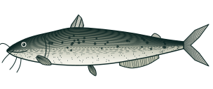
Channel catfish

Ictalurus punctatus

78Worth the tripToday, 12 pm–1 pm

Water

No water reading here right now. Channel catfish bite in 60–85° water, best near 75°.

Why

Fish feed actively ahead of a pressure drop. Light chop — baitfish active, fish willing to feed. Holds 5–30 ft down.

Keep

no daily limit

Open. Keep fish within the limits. South Carolina sets no daily or length limit for channel catfish; the state nongame limits cover only blue catfish and American eel.

Verified Oct 23, 2026 · South Carolina

Season here: Mar–Nov, estimated from local air temperature, 2023–2025; there is no water gauge here. More on channel catfish

The water

  • Water temperatureNo reading
  • Barometer30.41 inHg, steady

Sun, moon & solunar

  • Sunrise today7:39 am
  • Sunset today6:36 pm
  • MoonFull, 100% lit
  • Minor solunarToday 7:40 am–8:40 am
  • Major solunarToday 12:20 pm–2:20 pm
  • Minor solunarTonight 6:10 pm–7:10 pm

Solunar tables are a popular heuristic. A peer-reviewed test found they don’t predict catch on their own, so here they only nudge the score when the tide or moon already agree. How the score works

Fishing report

South Carolina DNR report, undated

Names crappie, which people fish for here. It covers the whole state, so it may not describe these waters.

Read it at South Carolina DNR

Licenses and rules: state fishery agencies · fish-consumption advisories

About this spot

A Duke Energy reservoir of 13,443 acres on the South Carolina–North Carolina line between Rock Hill and Charlotte. SCDNR manages it for largemouth bass, crappie and catfish and maintains six fish attractors; bank fishing is available at Ebenezer County Park.

SC: 14" bass minimum, 5/day. A popular metro-Charlotte tournament lake.

Nearby

Public spots within 40 miles, with the same 36 hours of floats.

Lake Norman32 mi · North CarolinaBest tomorrow 2 pm–3 pm
96Go

Questions people ask

Do I need a fishing license to fish at Lake Wylie?

Yes (anglers age 16 and older). To fish at Lake Wylie you need the appropriate state fishing license. See the agency's current rules: the state agency website

What fish are commonly targeted at Lake Wylie?

Lake Wylie is listed on this site for 3 commonly-targeted species: Largemouth Bass, Crappie, Channel Catfish. Which species is currently in season and which is scoring highest today is shown in the per-species ranking on this page.

When is the best time to fish at Lake Wylie?

It depends more on the species and the day's conditions than on a fixed "best hour." Water temperature, weather, and — at tidal locations — the stage of the tide drive activity most. The per-species ranking on this page scores every target species at Lake Wylie against today's live conditions, so the fish near the top are your best bets right now; check back as conditions change through the day.

What kind of access does Lake Wylie have?

Lake Wylie has multiple access types — pier, shoreline, and at least one public boat ramp. SC: 14" bass minimum, 5/day. A popular metro-Charlotte tournament lake.

Which state's fishing regulations apply at Lake Wylie?

state agency regulations apply at Lake Wylie. Size limits, creel limits, and seasonal closures are listed per species on each species page. Always confirm against the agency source linked from each regulation block — emergency closures can take effect mid-season.

Is Lake Wylie tidal water?

No. Lake Wylie is non-tidal — water level varies with rainfall, seasonal flow, and (where applicable) upstream dam releases rather than tidal exchange.