Fishing in Rhode Island public spots, conditions & reports
3 of 3worth the trip today
Mostly striped bass today. Each spot is scored for whatever is in season and biting best there.
Hold Ctrl and scroll to zoom
Every Rhode Island spot
3 public spots, best first. Each is scored for whatever is in season and biting best there.
The state report
Rhode Island DEM hasn’t published one we can date.
Licenses and rules
Rules for what people fish for here
- Striped bass28" minimum · 31" maximum · 1 a day1 fish at 28" to under 31", open all year. Non-offset circle hooks required when fishing with bait.Open · Rhode Island · verified Oct 23, 2026 · source
- Summer flounder19" minimum · 6 a day19" minimum, 6 fish a day, Apr 1–Dec 31. At listed shore sites (Fort Adams, Fort Wetherill, the Harbor of Refuge walls and others) 2 of the fish may be 17".Open · Rhode Island · verified Oct 23, 2026 · source
- Bluefish5 a dayNo minimum size. 5 fish a day from shore or a private boat, 7 on for-hire vessels. Open all year.Open · Rhode Island · verified Oct 23, 2026 · source
Limits differ by water. Each spot page shows the limits for its own water.
What’s biting in Rhode Island
Species people fish for at Rhode Island spots, and how many of those spots are worth the trip for them today.
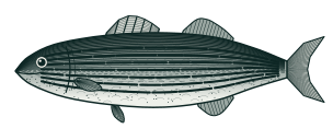 Striped bassMorone saxatilis
3 of 3 spots worth the trip in Rhode Island
Best now at Scarborough, RI100
Bites in 50–72° water
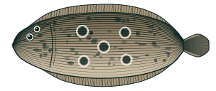 Summer flounderParalichthys dentatus
3 of 3 spots worth the trip in Rhode Island
Best now at Scarborough, RI82
Bites in 58–75° water
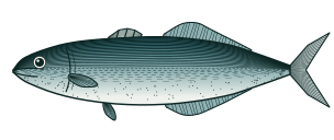 BluefishPomatomus saltatrix
1 of 3 spots worth the trip in Rhode Island
Best now at Block Island, RI98
Bites in 60–80° water
About fishing in Rhode Island
Rhode Island's 3 public access points span the Atlantic coast, across 2 counties. Across them, the species anglers most often target are Striped Bass, Bluefish, and Summer Flounder. Each is scored live on water temperature, tide, moon phase, barometric pressure, and weather. Always confirm current size, creel, and season limits with the Rhode Island state fishery agency before keeping fish — we flag any species whose regulations we haven't yet verified.
3 public access points across 0 water bodies. Data from NOAA, NWS, USGS, and Rhode Island DEM.